A short carnage edit. Includes the following rivers:
Elands, Sabie, Umzimkhulu and White Nile.
*No cows were harmed
A short carnage edit. Includes the following rivers:
Elands, Sabie, Umzimkhulu and White Nile.
*No cows were harmed
A short edit of the sweets that Zimbabwe has to offer.
|
Mac-Mac River – Lower MacMac |
|
| Grading | III to IV (V) |
| Levels / gauges | Visual: Confluence of Sabie & Mac-Mac (if it runs brown and the Sabie is up, it should be good to go)
Alternative is gauge (DWA hydrology site) Mac-Mac @ Geelhoutboom: 5m3 and up. |
| Put-in | 25° 0’11.40″S ; 30°55’25.26″E |
| Take-out | 25° 1’49.30″S ; 31° 1’33.10″E |
| Estimated time | 3.5 to 5hrs |
| Length | 17km |
| Gradient | 15m/km |
| Portages | Venus Falls portage (possibly two other depending on water levels) |
| Hazards / Notes | Low level bridges / trees |
| Fun factor | 3 / 5 (Nice one if the water is right) |
The Mac-Mac is hard to get at the right water levels. The catchment is right next to the Sabie’s catchment, but doesn’t hold water as well as the Sabie. The lower Mac-Mac is in some ways easier than the Sabie U2 section with longer pools between sets of rapids. The river is easy to paddle with all major obstacles being marked by bridges (be it low level or ones you can paddle under).
The put-in is at the Sappi Forest Service Station. Drive on the R 535 from Hazyview to Graskop. About 25km from Hazyview you will see a turn-off onto a dirt road with a sign saying Sabie to the left. Take this road and drive down (might need 4×4 if rainy) until you cross the Sunlight stream bridges. You can either put-in here or drive further to the Mac-Mac. The Sunlight stream provides a bit of warm-up in the way of low volume creeking.
The take-out is at Induna Adventures (ask permission to take-out on their property).
On the river:
The Sunlight stream has a short steep section before it joins the Mac-Mac. Once you are on the Mac-Mac the volume should pick-up a bit. The rapids that follow are easy to boat scout and all are runable. The river banks are mostly flanked with indigenous forest with pine plantations on the valley sides.

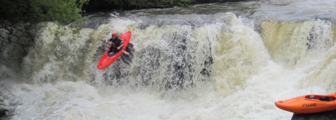
(Typical Rapid Mac-Mac)
The first major obstacle and still a portage at the moment (needs some time to work on a line) is Venus Falls. The falls are 2.5km from the put-in and marked by a low level bridge. If you see a steep increase in gradient and a horizon line, eddy out on the right. Take a look at the slide / falls. The best place to portage is on the right side, so follow the road down to the picnic site.

(Venus Falls)
After Venus Falls the river carries on with the same characteristics as above the falls. All rapids are good to go and there are only two sets of rapids that require some scouting. The first is marked by a bridge you can paddle underneath. There is a nice undercut on the right side and this rapid leads into a slide. This bridge marks a set of cascades and slides. There are lines down most of the slides/drops, but can get a bit tricky if the water is up. Scout on the right side. Depending on water level, the portage might be easier on the left hand side (high water).

(Cascade Section)
The last set of rapids contains a huge syphon at the end. The set is marked by a bridge (you can paddle underneath it). Best is to get out early and scout the rapid. The last drop contains a syphon (read big syphon). The river cuts to the right over a drop with the syphon being in the lead-in to the drop. It is easy to portage on the right.
Once the syphon rapid is done, cruise down to the take-out.
Just a word of caution: There might be crocs on this section, so keep a look-out. There is definitely crocs closer to the take-out so just ask the guys at Induna Adventures if it is something to be concerned about
The Lower Mac-Mac section is a good option if the Sabie is too high and if the group needs a bit of confidence.
Short video of Gatsien wave located about 15km out of Parys on the Vaal River. Water level for this clip is between 70cumecs to 100cumecs.
Access is gained via Stonehenge Adventures (Access is about R15).
|
Usuthu River – Particle Accelerator Section |
|
| Grading | IV – Grading lower if water is low.
At high levels Particle Accelerator goes up to a V with the section towards the prison being IV+. |
| Levels / gauges | No gauges.
Possibly dam level on South African Side. Check rain prediction for area and/or get hold of operators in Swaziland. |
| Put-in | 26° 34.185’S ; 31° 5.018’E |
| Take-out | 26° 35.295’S ; 31° 10.459’E |
| Estimated time | 3 – 5hrs
(Short section can be done in 2hrs) |
| Length | 13km total section
7km to short take-out |
| Gradient | 15m/km |
| Portages | None (possible weir before knife-edge) |
| Hazards / Notes | Weir / Ledge holes |
| Fun factor | 4 / 5 |
The putting is just off the MR18 on your way to Bhunya. The put-in as at a weir and this allows for a bit of warm-up before the section kicks-off. The section consists of steep sections and then flat pools. The flat sections tend to be manageable in medium to high water levels, but can get bony on low levels. An alternative put-in is just above Particle Accelerator (26° 34.816’S ; 31° 5.817’E).
There are two take-out options. For the full section carry, on past the woman’s prison and take-out on the left bank. The road to the take-out is off the MR4. The shorter take-out is just past the round-about (heading east) where the road runs close to the river again.
This section is really great if the water is up and can be done as a short run if you have limited time. The section starts out from the weir at the put-in. Jump in below the weir and warm-up on the flattish section until you reach Window Shopper. At low levels this rapid is more shallow channels, but at high water it turns into long continues rapid with several holes and pour-overs. You can scout from the side, but it is possible to boat scout and pick your line down.
Next rapid worth a mention is Particle Accelerator. AT medium and low levels work your way towards the centre channel and scout. At higher levels the centre channel closes and the channel far left opens up. Take your time and scout properly. There are some pinning possibilities at low/medium levels.

(Particle Accelerator – Left Channel)
Particle Accelerator is followed by some easy rapids and you will pass under a large bridge. Get ready for the next section of action. You will know you are approaching Knife Edge when you reach a small weir. Watch-out for this obstacle since a swim here can lead to you swim down the next set of rapids. You can scout on the left bank if the water is high or else scout from the right at medium and low levels.

(Knife Edge – medium levels. Pic by Brendan Bosman)
After the short Knife Edge gorge you have 3km of easy water. After this you will reach a point where the river shoots into several channels. Watch out for overgrown channels and possible strainers. The trick here is to pick the best and deepest channel. What normally works well is to start right and work your way left until you pass by the Prison on your left. After the Prison you’ve got about 2km to the take-out. If you miss the take-out, you can carry on towards the next large bridge (4km from Prison).
|
Gouritz River : Herbertsdale Section |
|
| Grading | II to III+ |
| Levels / gauges | None. Rainfall dependant so check the weather predictions. It needs to rain for a substantial amount of time. One way of checking if the N2 passing over the Gouritz outside of Mosselbay |
| Put-in | 33° 54.532’S ; 21° 39.145’E |
| Take-out | 33° 58.835’S ; 21° 39.275’E |
| Estimated time | 1.5hr to 3hrs |
| Length | 9km |
| Gradient | 5m/km |
| Portages | None |
| Hazards / Notes | Short isolated gorge |
| Fun factor | 3 / 5 |
Although this section is pretty flat in terms of white water, the section of river runs through an awesome gorge. The section is pretty short, but the logistics can take most of the day since the put-in ad take-out is off the normal road and the drive around is a bit more than the length paddled. So make it a day mission and have a picnic at the put-in and then paddle the gorge section. The section is also perfect for rafts (2-man) and the rapids are pretty straight forward.

The put-in is located on the R327 between Herbertsdale and Ladismith (about 30km outside of Herbertsdale). The take-out is on the road from Herbertsdale to Albertinia (driving south out of Herbertsdale it will be on your right – going west). The take-out is at a bridge crossing the Gouritz River.
The rapids on the section are towards the start and there are basically four notable rapids on the section. They are easy to negotiate and you can scout them from the side if need be. Once you go into the gorge, take is easy and enjoy the scenery.
|
Keur River : Montagu Pass |
|
| Grading | III+ to IV |
| Levels / gauges | None. Rainfall dependant so check the weather predictions. You can drive to the lower water bridge at the take-out and check if it is properly overflowing. Small catchment so you need to get it during or straight after rains. |
| Put-in | 33° 54.409’S ; 22° 25.114’E |
| Take-out | 33° 56.261’S ; 22° 25.313’E |
| Estimated time | 1.5hr to 3hrs |
| Length | 5km |
| Gradient | 25m/km |
| Portages | One (maybe two) |
| Hazards / Notes | Siphons / Undercuts / Logs |
| Fun factor | 3 / 5 |
The put-in for the section is on the Montagu pass where the pass crosses the river of a high bridge and then continues up the valley. The take-out is after the lime works at a low level bridge. The low level bridge can be used as a visual level marker with water needing to flow over the bridge by at least a foot and a bit for this section to work.
There are no gauges for this river and you need to check the rainfall predictions for the area and jump on it if it looks like good and solid rain for at least a full day or two. The catchment is super small and you run the risk of sitting in a low river bed if you get your timing wrong. Be careful of possible flash flood since the catchment is small and super steep.
The section has a lot of tree growth on the banks. This causes the river to be pretty continues with little eddies with not a lot of space for more than one boater. Check for tree blocks especially if there have been high flows.
The portage, pending scouting and water levels, are the first big drop that you will encounter. The river falls into a slot and shoots 90degrees to the left. This is about 800m into the run. The river runs next to the Montagu pass; however it is pretty tough scouting the river from the road due to steep banks and vegetation. Towards the end of run and at the lime works the action starts picking up again. The marker for the start of this is a low level crossing. Straight after this is a short slide. You can generally scout the rapids on this section from the right-hand bank.
If you are not familiar with this run, do it earlier in the day since it can turn into a mission if you have to exit the trip. If you have to cut the trip short, get out on the right-hand bank and check for forestry roads leading back up to the pass.
Video of Thrombi at higher levels (about 50cumecs).
Video is there to give a feel of what to expect at higher levels. The section becomes more continues and pretty sweet.
Here is a video guide for the Thrombi Gorge section of the Umzimkulu River.
Water level was on the low side.
For more details on the section go and check out the blog entry.
Video guide for the Ash River near Clarens.
For full details go and check out the Ash River guide entry.
